
Territory Map Google Maps
Description
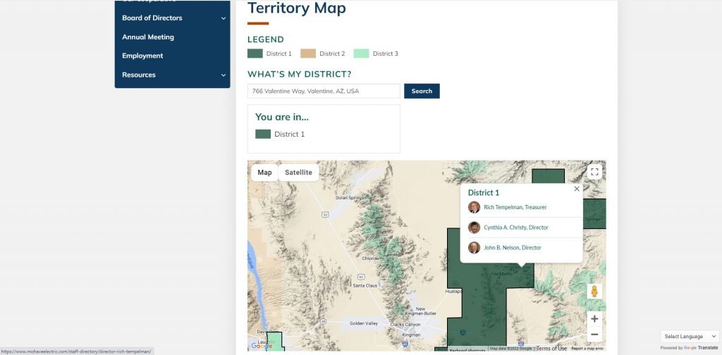
This was a small project but highlights my versatility with working with different APIs. This project utilizes the Google Maps API.
You can search what district you are in via the places search. This leverages the places API and will auto populate places when the visitor begins to enter their address.
It contains a geofence restriction logic where if you put in an address and it is not within the confinements of the geofence it will throw an error.
It contains logic that will grab the longitude and latitude coordinates of the address you enter and output what district you are in.
It has a dynamic modal pop up when you click on a district and will pop up the board members of the district you clicked on.